 |
SELWORTHY Coast and History Day Five: 5th May 2009 |
|
| Day Five Burgundy Coast Hurlstone St Agnes Selworthy Bossington Return Postscript Features Read Me |
Day 5 - "Rugged Path" & Selworthy
On my last full day in Minehead, I tried to "fit in" as far as possible, those aspects I had missed earlier. The nice "rugged" coast path and the village of Selworthy proved to be good items on the agenda as the following pictures reveal. My walk turned out to be a mere 17 miles long. Well, I had to get my money's worth, after all.
High Town to the Burgundy Chapel
My walk started via Higher Town. So up the famous steps I went and reached the open countryside surrounding Bratton Ball. Being of a naturally inquisitive nature I thought I'd pay a visit to the Burgundy Chapel by the sea shore. So it was a steep descent and of course a steep ascent to regain my originally intended path. The Burgundy chapel - or what's left of it - is believed to have been built by the Luttrell family, in thanksgiving for a safe return from the wars in Burgundy. Engagements such as this Burgundian engagement are what may have given rise to the Luttrell motto, namely, "what has been gained by war should be skilfully protected".
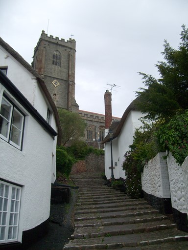
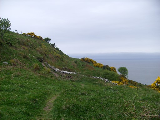
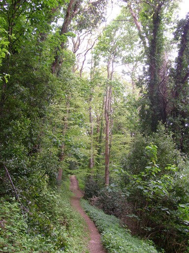
The coastal path was easily reached via the famous Minehead steps behind our hostel.
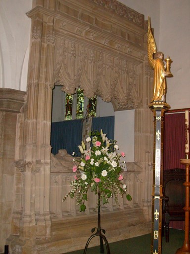
A quick look inside St Michael's church in Minehead to make sure the long term residents are OK. Somebody had brought them some nice flowers.
The weather started a bit sombrely as I ambled up to the coast path from behind our hostel.
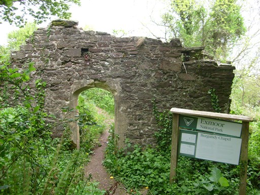
Before reaching the "rugged" path, I could not resist making the detour - a very steep and slippery drop of about 150m - down to the Burgundy chapel - or what was left of it. It is believed to have been built by the Luttrell family of Dunster Castle, in thanksgiving for a safe return from the wars in Burgundy - here we had an interesting mix of fighting and religious fervour! On starting the way back up, I met a couple of mountain bikers who were told this was a good footpath, but the giver of the advice did not know that they were mountain-bikers and not walkers! I'm not sure if the bikers eventually managed to struggle up to the top of the ultra-steep and slippery path, CARRYING their bikes! This was another example showing that mountain biking and walking are not necessarily equivalent!
Rugged Coastal Path
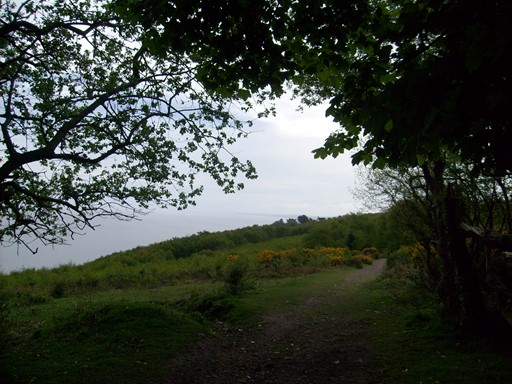
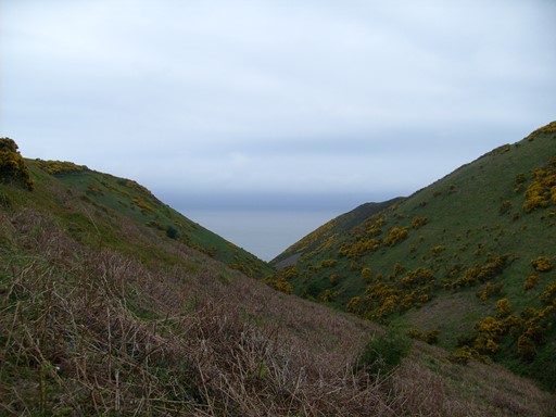
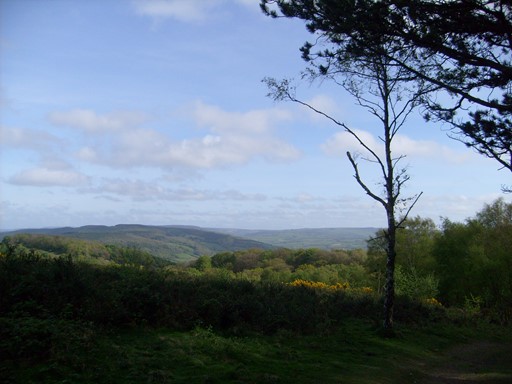
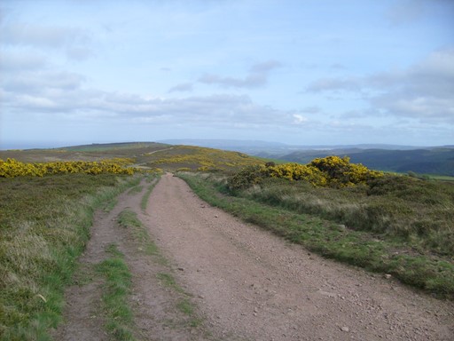
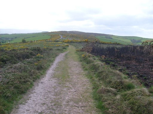
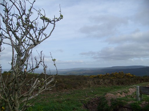
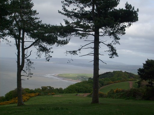
The path I have called the "The Rugged Path" deviates from the somewhat higher South West Coast Path. However, "The Rugged Path" has - so I realized at the end of the day - many more undulations, rapidly descending into and out of those numerous "combes" or "coombs" (choose the spelling you prefer) which characterize the hillier coastal regions of the south west.

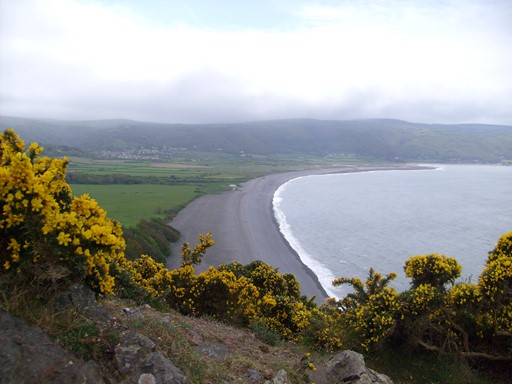
Back up on the coast path, I diverted to the "rugged" path and admired the yellow gorse that was blossoming in many places. Just imagine, for three miles, the "rugged" path offers no access to roads or parking places - enough to make the faint-hearted collapse from a petrol or diesel fume deficiency!
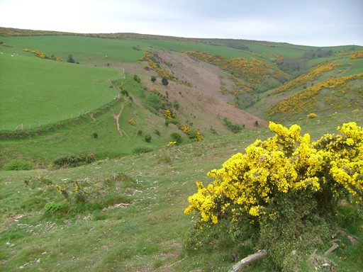
Grexy Combe (strange name!)
Looking East.
Looking towards Cymru.
Looking back east again.
The Welsh coast is out there.
Getting further from Minehead.
Another Combe.
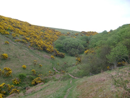
And another Combe.
Hurlstone Point
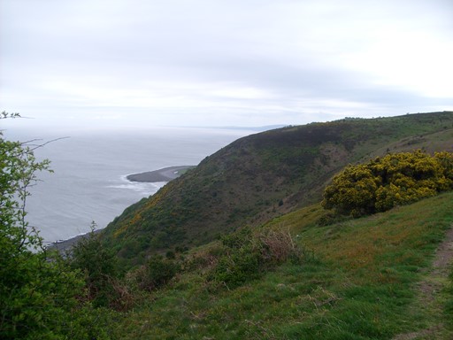
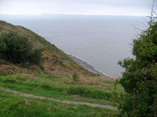
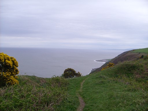
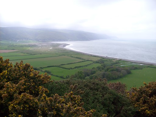
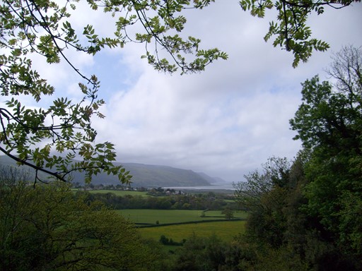
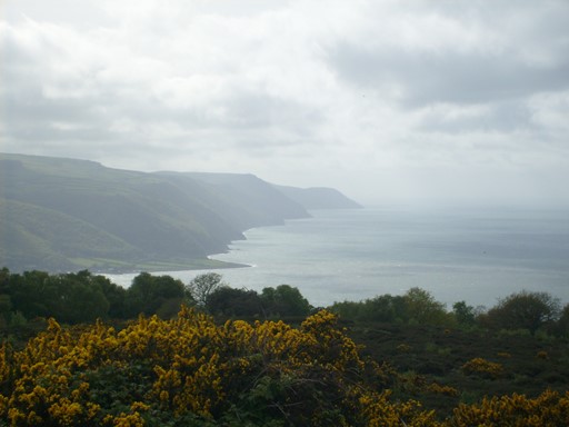
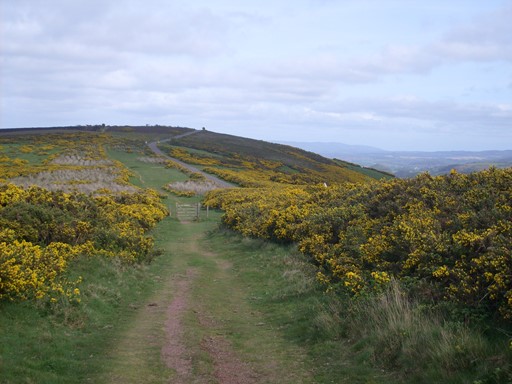
Eventually the aforesaid two paths join up and it's only a short northwards deviation to the promontory called Hurlstone Point. Here the remains of an old coastguard station look out across the sea. The station was built in 1900 and manned permanently until after WWII. What was the origin of the name "Hurlstone Point"? Were stones actually hurled from this promontory? If so, why? A local ritual? Whatever the mystery, the views from here westwards across Porlock Bay are impressive.
I finally reach Hurlstone point with its splendid view to Porlock Bay and beyond, the way we came on Sunday. Why were stones hurled from this point? A local ritual?
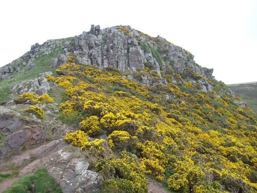
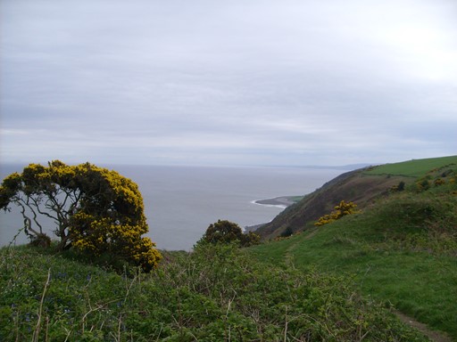
At Hurlstone point there are rocks and bright yellow gorse ...
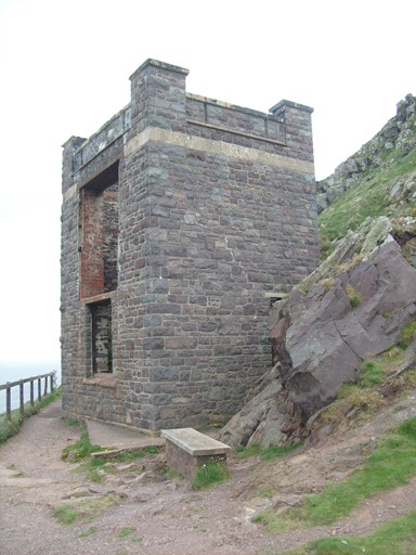
... and in front of these, the old coastguard station, which looks a bit like a mediaeval castle.

View from the old coastguard station at Hurlstone point.
How nicely the bright gorse enhances the majestic scenery.
Saint Agnes's Well
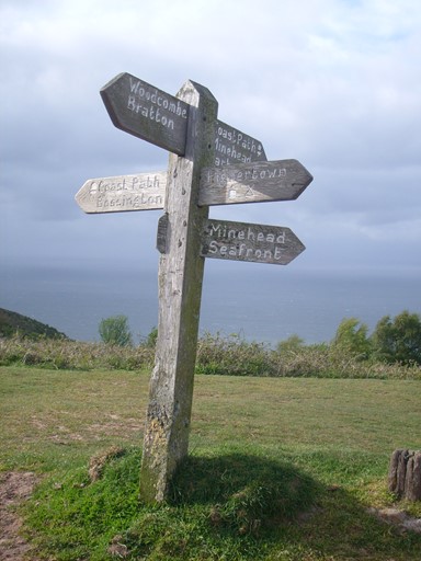
Why complete the little bit of the coast path to Porlock, when I can go on to Selworthy? So it's goodbye Porlock Bay and round the other side of the "mound" behind Minehead. The path led past Saint Agnes's Well and on to "picture postcard" Selworthy. On the way, there were good views towards Porlock and Dunkery Beacon.
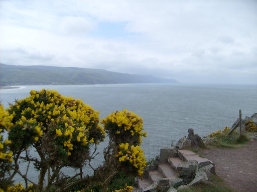
Before "turning left" towards Saint Agnes's Well and Selworthy, I got this fine view of Porlock Bay and the coastal path we took yesterday from Lynmouth down to Porlock.
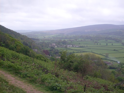
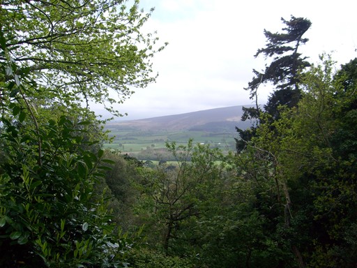
A view, from the path to Selworthy, of the Dunkery Beacon massif,
where three of us were on Saturday.
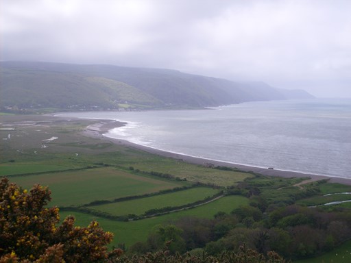
Last view - for the moment - of Porlock Bay. The clouds were lifting as the view from Bossington Hill would confirm later in the day.
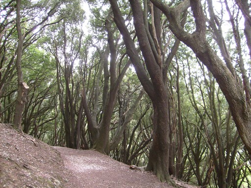
Enchanted forest.
More sylvan enchantment - of the verdant kind.
View from St. Agnes's well across to Porlock Bay. Here I met a party of octogenarians, all enjoying a country walk. How will my bones shape up in a few years' time?
View from St. Agnes's Well
across to the rise to Dunkery Beacon, where we were on Saturday.
Another view from St. Agnes's Well
across to the rise to Dunkery Beacon, where we were on Saturday.
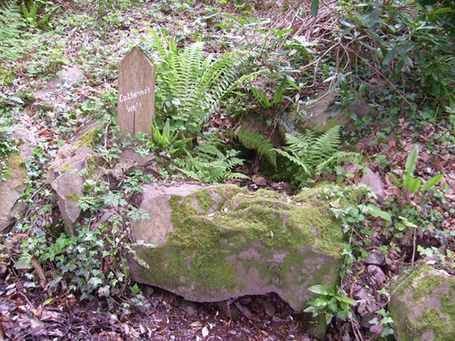
The path to Selworthy passes one of the wells
named after children of the original landowner hereabouts.
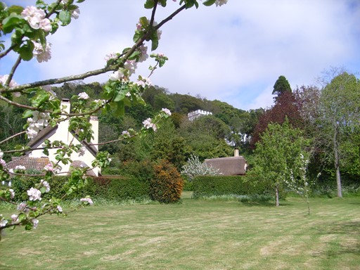
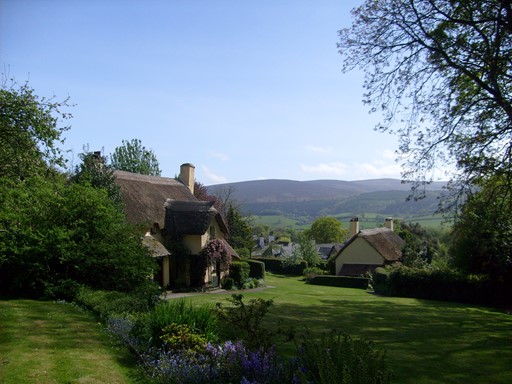
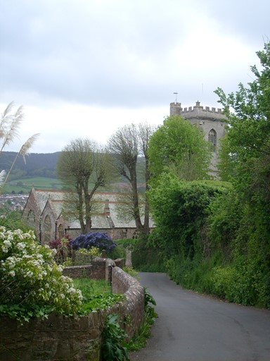
Selworthy
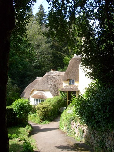
A maze of paths leads through the woods to Selworthy village, a village which is an expression of the timeless ingredients of English rural life. I mean, the thatched cottages with their whitewashed walls couldn't really be anywhere but in England. It's definitely National Trust territory. Selworthy Church, mainly 15th century, presides over this feast of Englishness.
And so to Selworthy Green. Thatched cottages and the white church hove into view.
The thatched cottages are now National Trust and their presence will delight us for years to come - unless it is deemed good to flatten them with a nice boring housing estate full of takeaways.
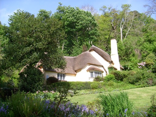
Like mushrooms, the thatched roofs sprout out of the foliage.
Ye olde tea shoppe, selling Tiptree Jam from Essex in Somerset. Prospective customers have the option to pause to admire the massif of Dunkery Beacon before diving in for their afternoon repast.
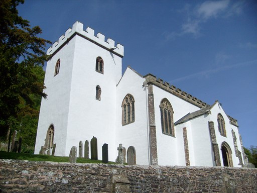
Selworthy's Grade I listed Church of "All Saints" is mainly 15th century and seems to have a bit of a Caribbean air, especially as the sun is shining - but no, it's Somerset, not Barbados!
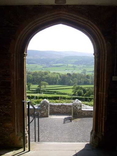
I enter the church through its south-facing porch.
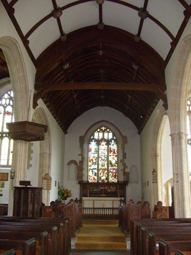
This looks like an arrangement for special sermons.
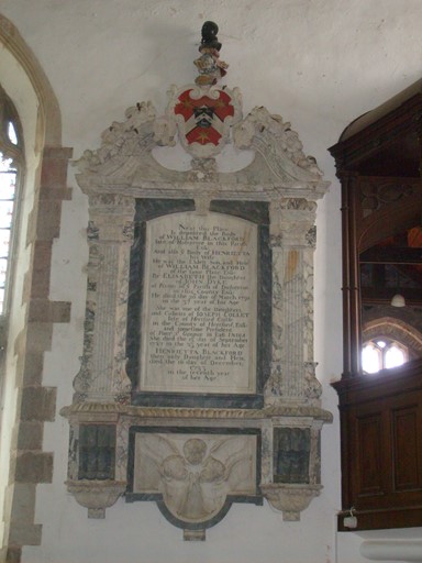
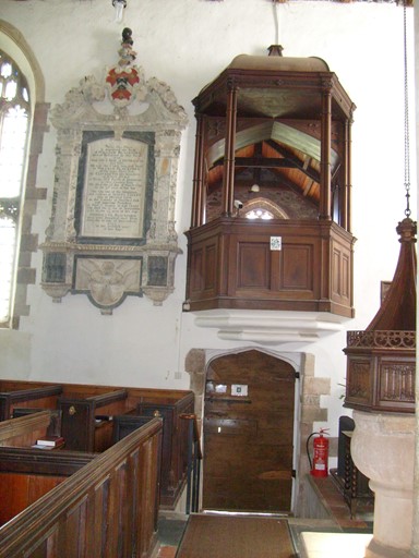
The memorial to the left is to members of the members of the Blackford Family and refers to the year 1733. It highlights a connection with the "President of Fort St George in East India". By today's standards, three of the persons referred to died relatively young - ages 7, 23 and 37.
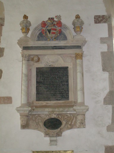
Memorial erected 1701, to Charles "Staynings", his wife and daughter.
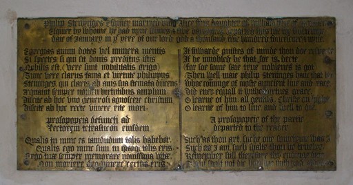
This memorial is dedicated to William Stenynges who "departed this lyfe the fivetenth daie of January in ye yere of our lord god a thousand five hundred four score and nyne" (i.e. 1589). (The spelling is of course in Tudor English). William's wife is also mentioned and the text is written in both Latin and English.
View from Selworthy church porch over to the Dunkery Beacon massif.
Bossington Hill
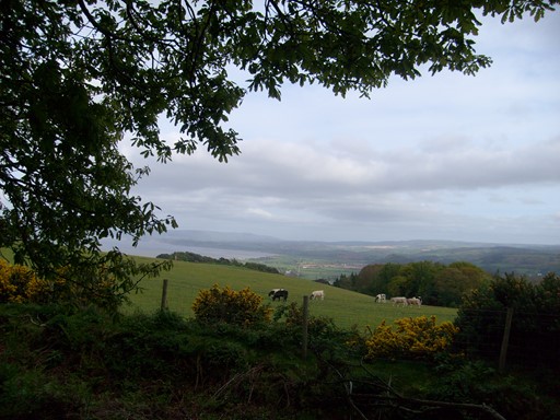
On leaving Selworthy I once more rise to higher things, taking the South West Coast Path which I had eschewed earlier in the day. It's an easy path along the ridge with good views seaward and landward. On the way I get to Bossington Hill, with its unforgettable view over Porlock Bay. Then I reach the Acland shelter. After this comes Selworthy Beacon, which at 308 m (1013 feet), has the honour of being a Marilyn.
Coming up from Selworthy to Bossington Hill and Selworthy Beacon.
It was calm in Selworthy but windy on top.
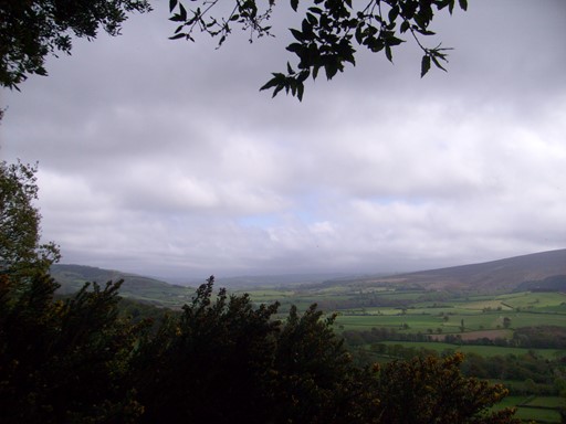
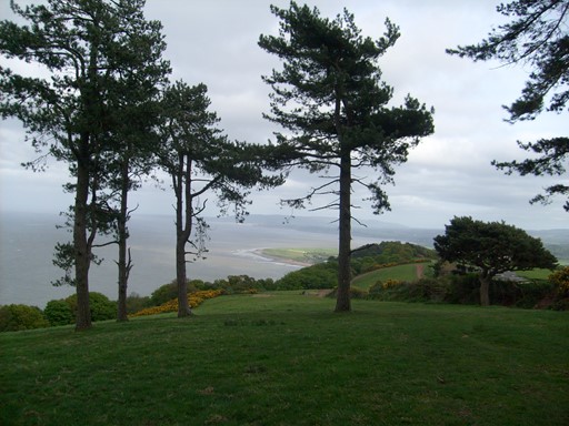
Bossington Hill: sea, gorse, hills and mist all combine to produce an unforgettable view of the
coast line from Porlock to Lynmouth.
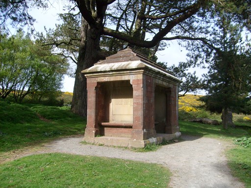
This is a "Wind and Weather Hut" erected in 1878 by the then local landowner John Acland for use by his family "on Sunday walks".
The wind was a known phenomenon in these parts, so it would seem.

Selworthy Beacon: looking towards the Dunkery massif.
Selworthy Beacon: the sea is on the right.
From Selworthy Beacon I took the ridge path (slightly to one side of the official South West Coast Path). From this ridge path there were good views
to both the seaward (left) and the landward (right) sides.
Getting closer to Minehead.
Looking back to Selworthy Beacon.
Return to Minehead
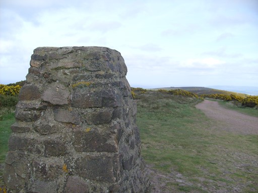
Still espousing the higher ground I come to another beacon (OS Trig Point), which I think marks the summit of Bratton Ball. More nice views, especially towards Minehead and Dunster. Scots Pines and a horse paddock. And now I have reached Higher Town. A very nice bracing walk, sunny although windy on top.
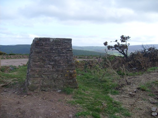
And here is a new beacon!
View from the new beacon towards Minehead and Dunster.
Deja vu! This is where the rugged and the not so rugged coastal paths and the steep descent (which I made earlier) to the Burgundy chapel all meet.
A pastoral scene on the way to Minehead.
Getting close to Minehead. The Scots pines are dancing in the breeze.
Almost in Higher Town.
This is the church of St Michael - the hostel is almost round the corner, or rather, down the famous Minehead Church Steps.
Postscript
I travelled back the next day, mid-week and mid-day. The train to Paddington was largely empty (they had even forgotten about the annoying seat reservations) and it took the quiet cross-country route from Taunton via Pewsey, Newbury and the Vale of the White Horse (the horse was clearly visible on the hillside) to Reading and on to Paddington. No engineering works.
Once again, Many Thanks to all who made this CLOG away-break such an unforgettable success!
Revised: 2017-06-08 @12:37
SAGAX REX HANC RETIS ORBIS PAGINAM PINXIT ANNO MMXI ET MMXVII
© Eric Scharf 2017